
Bridge to Nowhere: Hike, History, Bungee Jumping & Safety
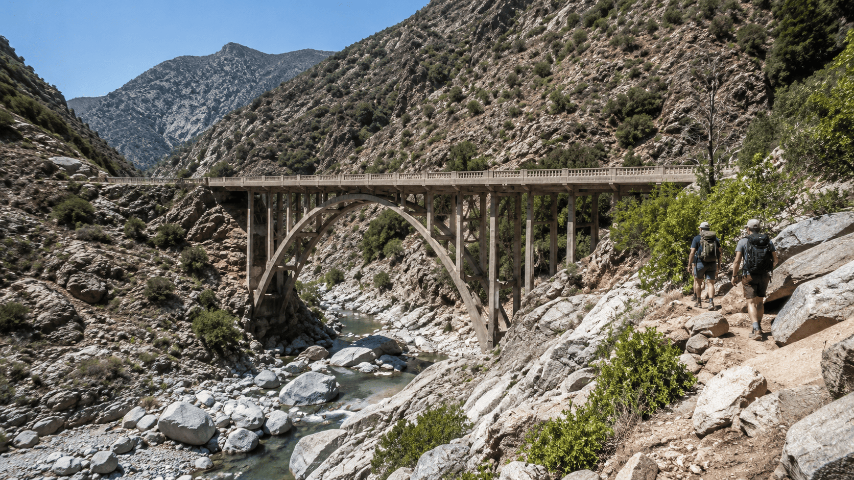
The Bridge to Nowhere is a historic concrete arch bridge deep in the San Gabriel Mountains, north of Azusa, California. Reached by hiking the East Fork Trail in Angeles National Forest, it is both an unusual remnant of an abandoned 1930s highway project and one of Southern California’s distinctive hiking destinations. (fs.usda.gov) Visitors come for the rugged canyon hike, river crossings, mountain scenery, and the bungee jumping operation located at the bridge.
Bridge to Nowhere Quick Facts
| Quick Fact | Details |
|---|---|
| Location | San Gabriel Mountains, California |
| Trail | East Fork Trail |
| Distance | About 10–11 miles round trip |
| Elevation Gain | About 1,140–1,250 feet |
| Hiking Time | About 4–6 hours |
| Difficulty | Moderate |
| River Crossings | Several |
| Bridge Height | About 120 feet |
| Parking / Pass | $5 day-use fee / accepted passes (fs.usda.gov) |
| Current Status | Open for hiking only as of August 2026 (fs.usda.gov) |
History
The Bridge to Nowhere was built in 1936 as part of an ambitious road project through the San Gabriel Mountains in Southern California. The planned highway was intended to connect the San Gabriel Valley with Wrightwood, creating a direct route across the mountains. Construction crews built the concrete arch bridge over the East Fork of the San Gabriel River while work continued on the surrounding roadway.
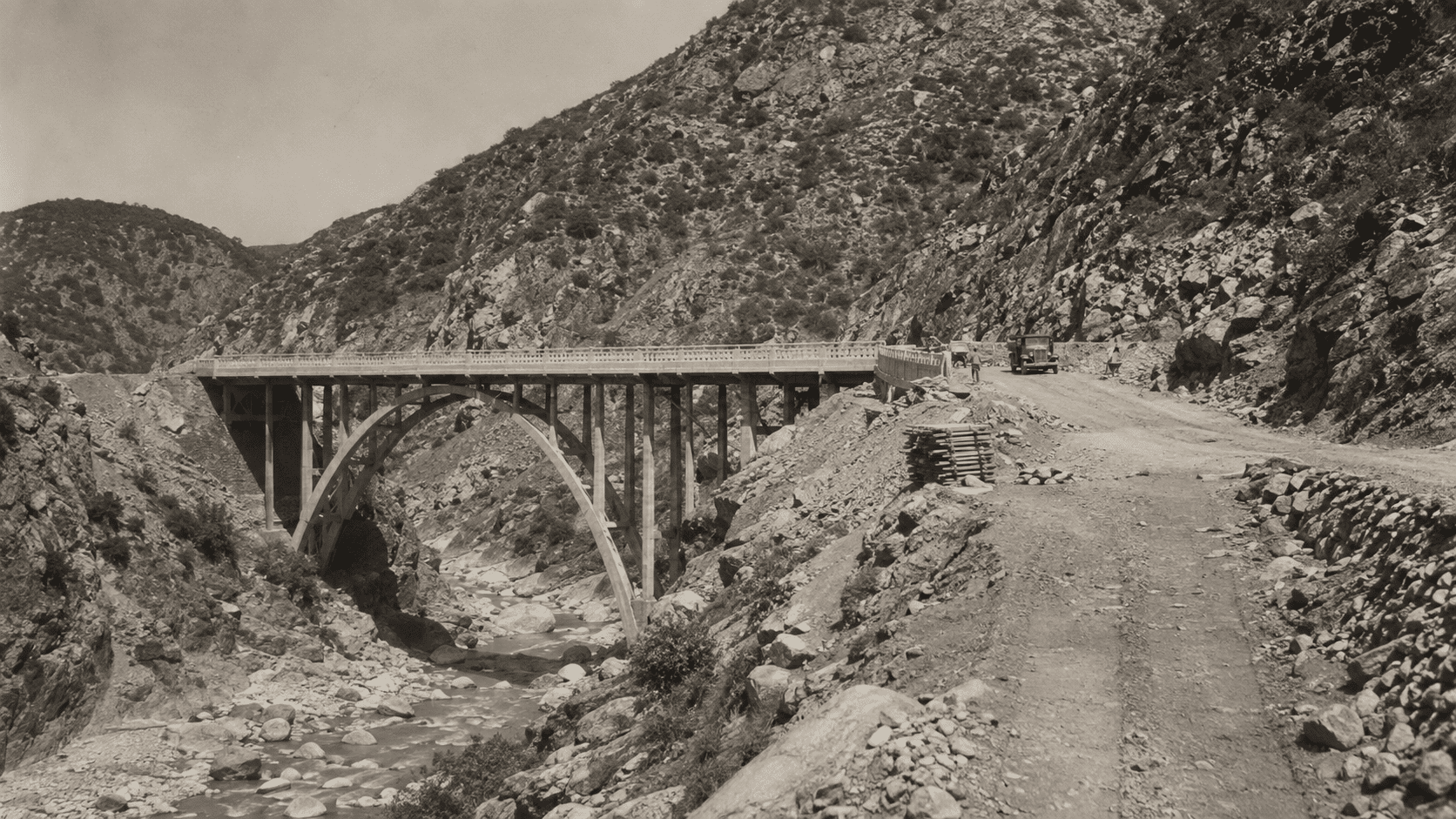
The project changed dramatically in March 1938, when severe flooding swept through the canyon. The flood destroyed large portions of the unfinished road and damaged the infrastructure needed to complete the route. Rather than rebuild the costly mountain highway, officials abandoned the project.
The bridge itself survived, but without the road it was meant to serve, it became an isolated structure deep in the canyon. This unusual history explains both its name and its enduring appeal. Today, the Bridge to Nowhere in the San Gabriel Mountains stands as a reminder of an abandoned transportation project and can be reached primarily by hiking the East Fork Trail from the Angeles National Forest.
East Fork Trail
The Bridge to Nowhere is reached on foot via the East Fork Trail, an out-and-back hike through the San Gabriel Mountains. The route follows the East Fork of the San Gabriel River and combines rocky canyon terrain, repeated water crossings, and exposed sections. Depending on the GPS track and turnaround point, hiking guides measure the round trip at roughly 10–11 miles, with about 1,140–1,250 feet of total climbing and an estimated hiking time of four to six hours.
Getting to the Trailhead and Parking
The hike begins at the East Fork Trailhead in the San Gabriel Mountains National Monument, within Angeles National Forest north of Azusa. The Forest Service specifically distinguishes this starting point from the East Fork Station, so hikers should navigate to the East Fork Day Use Parking Trailhead.
Bridge to Nowhere trailhead parking is limited, making an early arrival particularly useful on busy days. The Forest Service currently lists a $5 per vehicle day-use fee, and vehicles must be left only in designated or otherwise legal parking areas. A National Forest Adventure Pass costs $5 per day, while qualifying America the Beautiful interagency passes are also accepted where the Adventure Pass is required. Because fee rules can change, check current Forest Service information before your hike.
Route, River Crossings, and Trail Map
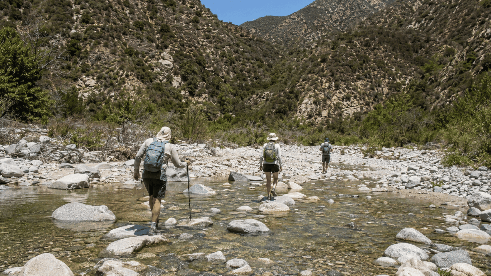
The Forest Service lists the East Fork Trail as 5.5 miles from the trailhead to the Bridge to Nowhere. During the first three miles, hikers follow a rocky streambed and cross the East Fork several times. The crossings are one of the defining features of the hike, but they also make navigation less straightforward than on a continuous maintained path.
A downloaded Bridge to Nowhere trail map or GPS route is useful because sections through the canyon can be difficult to follow. Popular hiking guides classify the route as moderate despite its relatively modest elevation gain, largely because of the distance, uneven terrain, and repeated river crossings.
What You’ll See Along the Trail
Much of the hike follows the river through a rugged canyon where traces of the abandoned highway occasionally remain, including small patches of old pavement. Along the East Fork, hikers may also encounter shaded pools and swimming holes, especially near the turnaround area, as well as small cascades or waterfall-like features when water levels allow.
The final landmark is the concrete arch bridge itself, rising unexpectedly above the canyon after miles without road access. The contrast between the isolated structure, flowing river, and remnants of the failed highway is what makes the East Fork Trail more than a conventional Southern California hike.
Bungee Jumping
Bungee jumping has become one of the Bridge to Nowhere’s best-known attractions. The concrete arch rises about 120 feet above the San Gabriel River, providing the dramatic setting for the Bridge to Nowhere jump.
The bridge sits on 50 acres of private property surrounded by the Sheep Mountain Wilderness, and Bungee America operates its permanent California bungee jumping site there. Reaching the bridge as a regular hiker is therefore different from participating in a bungee jump: jumpers and spectators must register with the operator and follow its scheduled program.
Bungee America currently offers weekend trips throughout the year, with some midweek adventures available by special arrangement. Because schedules, package prices, and availability can change, anyone planning a Bridge to Nowhere bungee jump should check the operator’s current booking information before making the hike. The experience is effectively a full-day outing, combining the roughly five-mile hike to the bridge with organized jump instruction and the return hike.
Safety Issues
River crossings and exposed canyon terrain are the main safety concerns on the Bridge to Nowhere hike. Conditions can change quickly, so hikers should check both trail and weather information before setting out.
River Crossings and High Water
The East Fork Trail crosses the San Gabriel River several times. During or after heavy rain, runoff can raise the water level quickly and turn normally manageable crossings into fast-moving, dangerous channels. The Forest Service specifically advises against crossing the stream during rainy conditions because of swift water.
The risk is real. In March 2026, a hiker died after being swept away at a river crossing on the Bridge to Nowhere Trail during high-water conditions. If the current is strong, the water is unusually deep, or you cannot clearly identify a safe crossing, turning back is the appropriate decision. Hikers should not rely on conditions from a previous visit because river levels can change rapidly.
Weather, Heat, and Essential Gear
Bridge to Nowhere weather can also make the hike more demanding. Much of the route is exposed, and temperatures in the lower San Gabriel Mountains can become very hot in summer. Carry enough drinking water for the full round trip, use sun protection, and consider starting early to reduce heat exposure.
Sturdy hiking shoes with good traction are important for rocky terrain and wet crossings. Trekking poles can improve balance in the river, while a downloaded GPS map or offline trail map is useful where the route becomes difficult to follow. Before hiking, check the National Weather Service forecast and current Forest Service alerts rather than assuming conditions will remain stable throughout the day.
Current Trail Conditions, Repairs, and Closures
As of August 2026, the U.S. Forest Service lists the East Fork Trail to the Bridge to Nowhere as open for hiking only. The 2024 Bridge Fire previously led to a broader area closure through December 31, 2025, but that closure has expired.
Conditions can still change after wildfires, storms, erosion, rockfall, or high river flows, potentially affecting trail sections and crossings. Current alerts should therefore be checked shortly before departure rather than relying on older Bridge to Nowhere news or trip reports. The Forest Service’s Angeles National Forest alerts page is the best source for official closure and safety information.
At present, fire danger in Angeles National Forest is rated Very High, effective July 24, 2026, although the current alerts do not list the East Fork Trail itself as closed.
Related Entries: